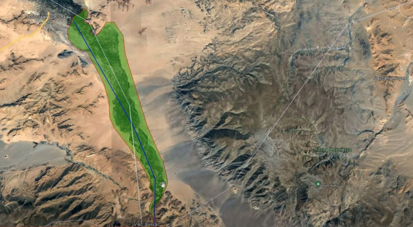
Khovd River Valley, Northwestern Mongolia
Planned pushes toward further industrialisation in western and southern Mongolia have led the Mongolian government to develop the Blue Horse Dam programme.
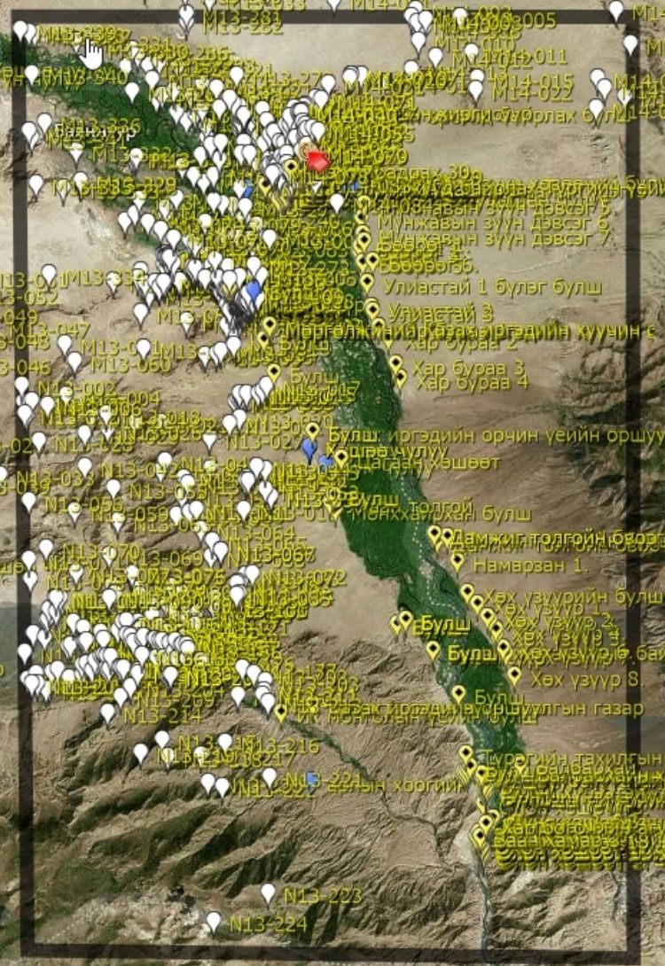
Blue Horse is intended to address the water and energy consumption requirements of expanding coal mining, coal processing, oil refining, and cement, copper, and steel production. The Erdenburen Hydropower Project has already begun construction on the Khovd River in Khovd Province, western Mongolia. By 2027 it will supply 90 megawatts of power to push Mongolia further toward energy independence. However, it is also planned to flood approximately 300 km2 of land along the river. This is displacing over 1,200 people in nearly 300 households, most of whom are mobile pastoralists who circulate seasonally between traditional campsite locales. It will also destroy or make inaccessible hundreds of archaeological sites. And so the dam project will impact the homes, livelihoods, and ethnographic and archaeological heritage of the local communities.
The MAPSS project, in collaboration with the Mongolian Institute of Archaeology, National Centre for Cultural Heritage, and Khovd University, is digitally integrating the several archaeological survey datasets that already exist for the flood zone, while complementing them with new data from manual remote sensing documentation, Machine Learning techniques, and drone mapping. This will provide a richly populated archaeological map for our local partners to use for further field survey of the region, enabling more rapid documentation and, thus, greater coverage before the dam construction submerges the landscape. As well, it will produce a geospatial digital record of the local nomadic heritage, which itself reflects a multi-millennia tradition of mobile pastoralism across the Mongolian steppe.
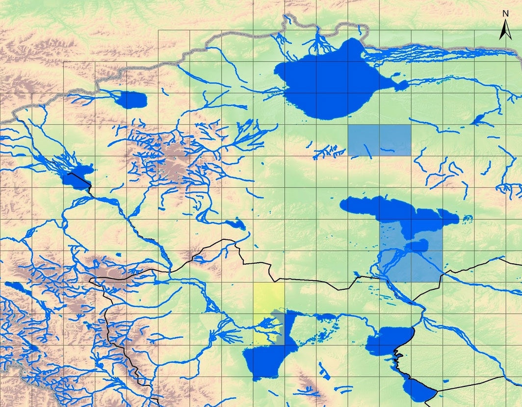
Great Lakes Depression, Western Mongolia
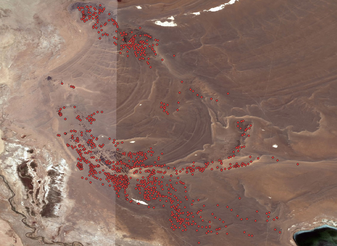
The Great Lakes Depression is a 100,000 km2 region in northwestern Mongolia bounded by four mountain ranges (Mongolian Altai, Tannu-Olga, Khangai, and Gobi Altai) and including six large lakes (Uvs Nuur, Khyargas Nuur, Airag Nuur, Khar-Us Nuur, Dörgön Nuur, and Khar Nuur).
One of the largest lacustrine depressions in Central Asia, its origins date to at least the Pliocene Epoch, and the lakes morphed dramatically during the mid and late Pleistocene. Investigations of Holocene habitation show that areas next to two of the freshwater lakes contain significant funerary remains dating to the Late Bronze Age. MAPSS analysts integrate documentation from remote sensing methods such as satellite imagery interpretation and Machine Learning with archival datasets, drone mapping, and settlement survey of the region. Our investigations are illuminating vast ancient burial landscapes against the backdrop of anthropogenic environmental change, while considering the nomadic nature of contemporary human settlement systems in the vicinity of these massive graveyards.